
9.4How do I look up property values in an area?
The Land value reference (RVF) is an interactive cadastral layer showing real property transactions, based on the DVF data published by the French tax administration. Available in France.
Turn the layer on
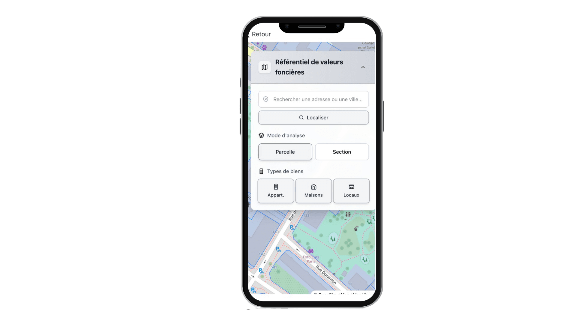
From the toolbar, tap RVF. The base map switches to cadastral sections and parcels, and your position is located automatically. You can also search for an address or a town, then tap Locate.
Analyse a parcel
Choose the analysis mode — Parcel or Section — then filter by property type: flats, houses, commercial premises.
The list of transactions appears, each showing the property type, floor area, sale price per m², date and address.
Export the summary
The button at the top of the page generates a PDF summary containing:
- the monthly median price chart;
- the breakdown of sales by property type;
- the rental reference for the current year;
- the potential and estimated gain after an energy retrofit.
Updated on July 25, 2026